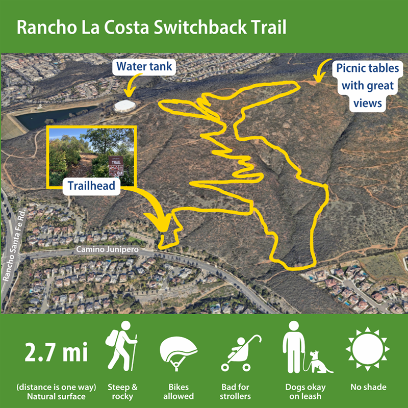
If you’re looking for a challenging hike where the reward is an incredible view, try out the Rancho La Costa Switchback Trail in south Carlsbad.
As the name suggestions, the 2.7-mile zig-zagging trail takes you to the top of Denk Mountain – the highest point in the city, at just over 1,000 feet. On a clear day you can see panoramic views of North County and the Pacific Ocean, from Camp Pendleton all the way to La Jolla.
The narrow, steep trail has an elevation gain of 692 feet and is quite steep in places. When you get to the top, you’ll find a shaded area with a picnic table, bike racks, a bike repair station and an information kiosk – all built by Eagle Scouts in our community.
-
The Switchback Trail is one of several trails within the Rancho La Costa Preserve, a 1,640-acre protected open-space area that’s home to more than 40 species of endangered or threatened plants and animals.
-
The abundance of wildlife is a magnet for scientific study and research, conducted primarily by the nonprofit Center for Natural Lands Management, which owns and manages the preserve, which is part of the city’s habitat preserve system.

The route
As the “switchback” name suggests, the trail leads you up the mountain diagonally. You can go back down the same way you came or take connecting trails that will get you down the mountain faster, though at a steeper incline.
What you’ll see
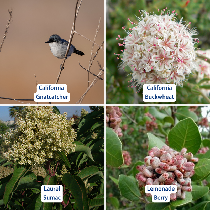
Beyond the spectacular views, the Switchback Trail is surrounded by coastal sage scrub that’s home to native plants like California buckwheat, laurel sumac and lemonade berry, along with a variety of wildlife including the endangered California gnatcatcher.

Denk Mountain is named for a pioneering Olivenhain family who once owned much of the land that is now the Rancho La Costa Preserve. Some people call it “Denk Tank Mountain” because of the large Olivenhain Municipal Water District water tank you can see through the brush about halfway to the summit.
The trailhead is at the corner of Corte Romero and Camino Junipero, east of Rancho Santa Fe Road. Street parking is available on Corte Romero.