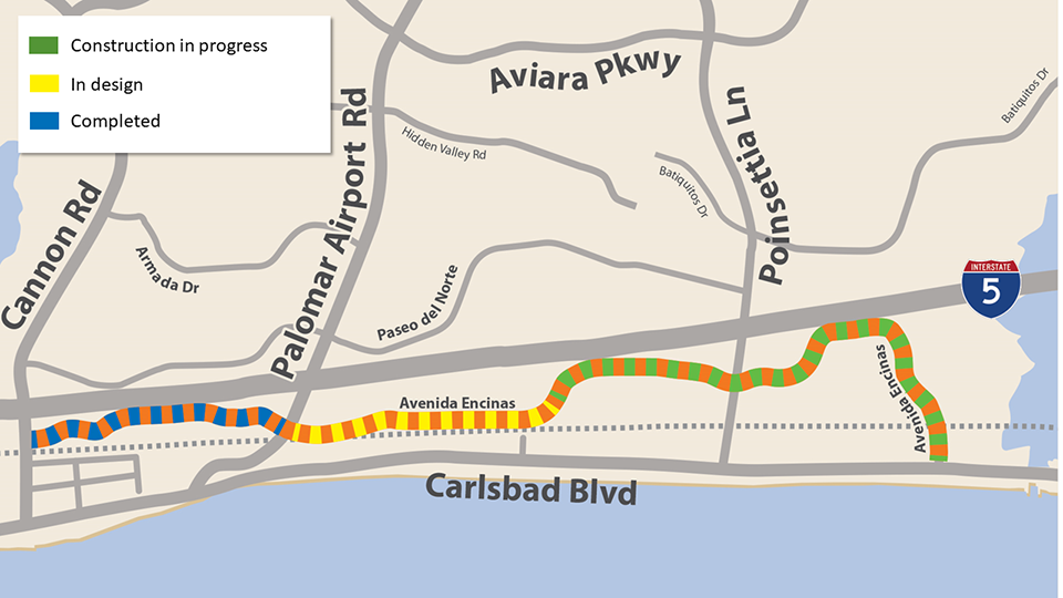
City staff will present proposed designs for traffic safety improvements along Avenida Encinas between Palomar Airport Road and the Poinsettia Coaster Station at the next Traffic Safety & Mobility Commission on June 3.
Traffic Safety & Mobility Commission
Monday, June 3, 4 p.m.
Carlsbad City Hall, 1200 Carlsbad Village Drive
Agenda
Read the staff report
Watch online
Comment in person on June 3 or email traffic@carlsbadca.gov
The safety enhancements on Avenida Encinas are part of a nearly 2.5-mile segment of the Coastal Rail Trail throughout southern Carlsbad. The southern part of Avenida Encinas (Segment 2), from the coaster station to Carlsbad Boulevard is currently under construction.

Construction update – Poinsettia Coaster Station to Carlsbad Boulevard
Repaving and restriping continues on Avenida Encinas between the coaster station and Carlsbad Boulevard.
Repaving, slurry seal and restriping require several steps:
- Repaving or slurry prep work requires a combination of grinding, striping removal and crack sealing.
- When areas are ready to be resurfaced we try to resurface one side at a time to maintain at least one lane of traffic and access to commercial centers. When one side is done, we switch to the other side.
- The new surface needs a little time to cure before it’s ready for new striping, but temporary traffic delineation will be provided.
- Completing all the striping and markings usually takes between two to four weeks.
Thank you for your patience as we complete this work.
Improvements include:
- Resurfacing and restriping to repair cracks and keep the road in top condition.
- Managing speeding by restriping driving lanes to appropriate widths and reducing the number of driving lanes between Poinsettia Lane and Windrose Circle.
- Installing a new mid-block crosswalk with a new pedestrian signal at Avenida Encinas and San Carlos Street. This new traffic signal will remain green for cars until a pedestrian pushes the button to cross. Then the signal will blink yellow and turn red to stop vehicle traffic and allow pedestrians to cross.
- Painting new, wider buffered bike lanes with dashed green paint in areas where cars and bikes share the road (usually approaching an intersection to turn right).
- Painting new high-visibility crosswalks and building new ADA-compliant ramps at:
- Poinsettia Coaster Station driveway
- Embarcadero Lane
- Macadamia Drive
- Raintree Drive
- Windrose Circle
- Dory Lane
- Painting new high-visibility intersection crosswalks across Avenida Encinas at:
- Poinsettia Lane
- San Lucas Street
- Portage Way
- Ponto Drive
- Carlsbad Boulevard
Avenida Encinas as part of the Coastal Rail Trail
As part of an overall goal of improving traffic safety in the city, Avenida Encinas is being used as part of the countywide Coastal Rail Trail.
The Coastal Rail Trail was initially planned in the 1990s as a continuous bicycle route that would run along the railroad tracks from downtown San Diego to Oceanside. According to SANDAG, logistics, costs and environmental concerns since its original planning have forced some areas of the route away from the tracks and onto side streets such as Avenida Encinas.
